Early Spring Hiking: Gaji-san
 |
| Fighting! |
Pohang's southern neighbor city, Ulsan, is just about an hour away by bus and is a little more cosmopolitan than Pohang. But thanks to Busan just an additional 30 or so minutes south, I really didn't spend much time in Ulsan last year. One thing it does have going for it is a little foreigner's market, where the local "waygooks" get together to sell hand-crafted things like South African sausage and jerky, curry, vegan cupcakes, American style cheese dips, and even some real cheese made by a guy with his own goat farm. There are cool non-food things, too, like greeting cards, handmade soaps, etc. If you're interested in checking it out, here is their Facebook group.
(PS: they're not the only foreigner's market around; check Facebook to see if there is one in your city in Korea.)
But last April I visited Ulsan not for it's foreign market but for the amazing hiking that's right on its doorstep. From Ulsan, you can catch a local bus out to a temple called Seoknamsa (석남사) which is right at the base of a peak called Gajisan (가지산). The bus ride out to the temple will take you through a really beautiful valley with a river cutting through it, and a few nice local restaurants.
 |
| River near our campground |
 |
| Super expensive gravel campsite |
Not really knowing what to expect in terms of campgrounds, we headed to the only one we could see online which was called an "auto campground". As you would expect, it was a big gravel parking lot mostly intended for RV campers, but there were a couple of Korean families tent camping like us. The campsites were not great for tents though, with all the gravel, and to make it even worse the cost was about 30,000 KRW (waaaay to expensive for camping.) Sadly, the next day when we headed to the temple to start our hike, we saw plenty of other people "free camping" along the river near the temple. I'd really recommend saving yourself 30 bucks and doing the same.
 |
| Trail map (Korean only) |
Our goal was to do day hike up to Gajisan that started at Seoknamsa and looped back around again at the end. It's a long hike, so we preferred to camp nearby the night before. The bus to the temple will let you out at Seoknamsa parking lot, across the street from the temple. There are shops here selling typical Korean food and you can buy some kimbap to go for lunch on the hike. To find the trail, enter the temple grounds and look for a small bridge on your right. Cross it and head to the right. Just follow signs reading either Gajisan or deungsanro, which means "hiking trail" in Korean (see the photos below.)
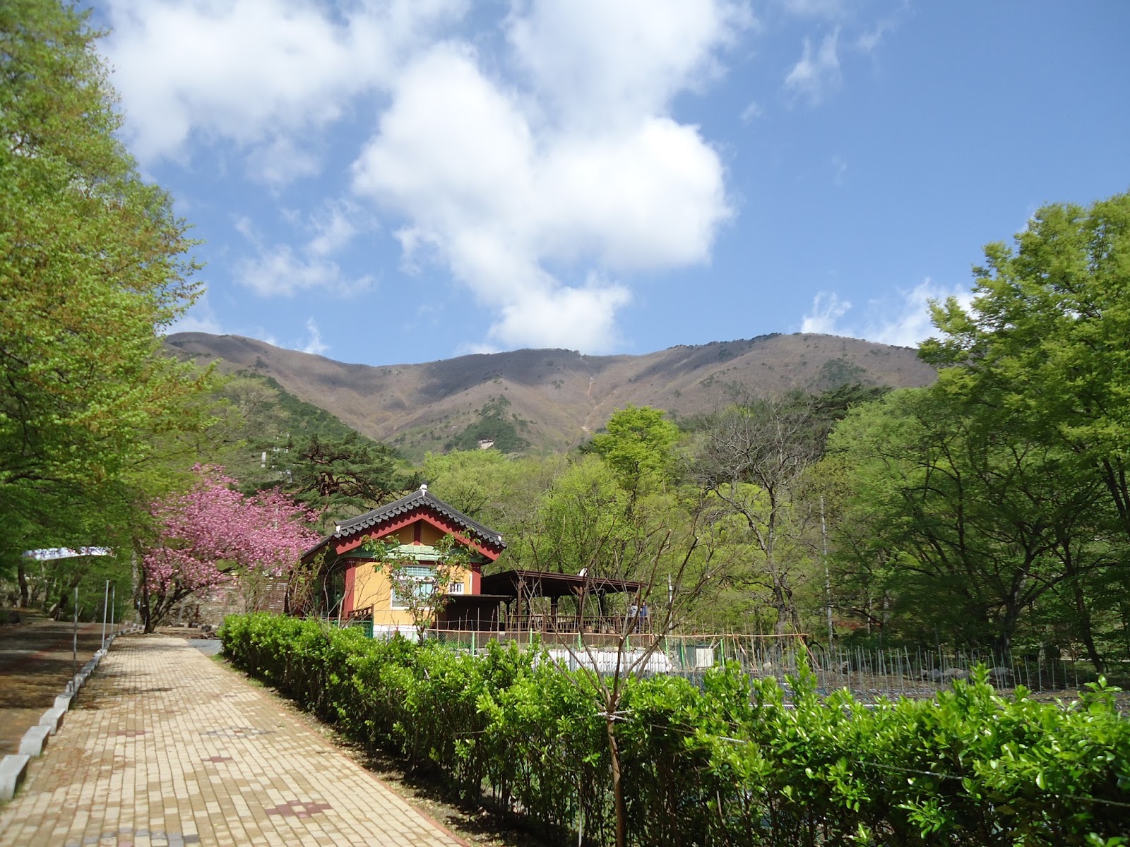 |
| Entering the temple grounds |
 |
| Crossing the bridge |
 |
| Trailhead to Gajisan, just 5.5km! (Straight up...) |
 |
| "Deungsanro", or hiking trail |
The first 1.5-2 hours are a steady climb up through the woods. We went in April, so the higher we climbed the more the forest looked like the middle of winter. There were a few signs of spring along the top, with some bright purple flowers growing here and there on the trail. And we were lucky to have sunny weather all day, but the ridge was exposed to strong, cold winds so if you go be sure to bring layers.
 |
| Sill at the t-shirt layer for now |
 |
| Spring flowers on Gajisan |
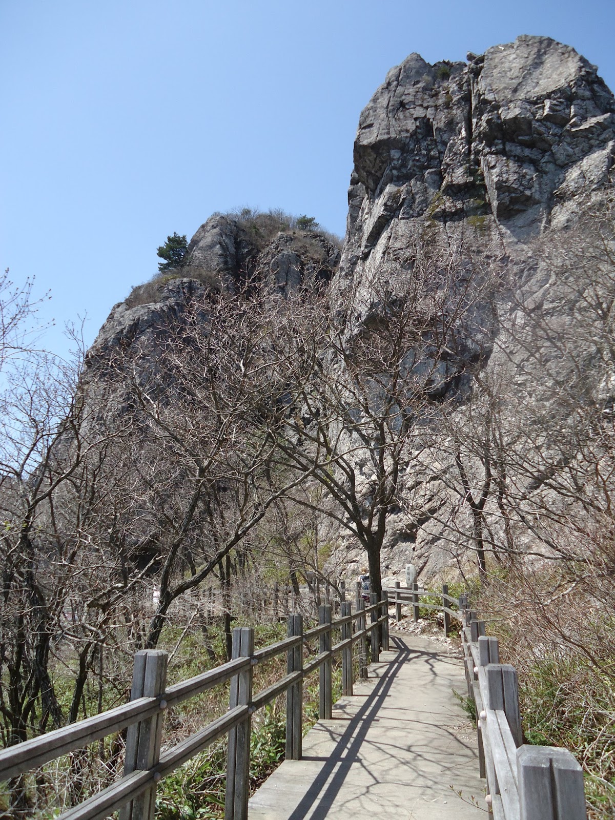
The first landmark we hit was this big rock with a little mountain hut next to it and a welcome dog that came to say hello.
 |
| A big rock! It had a name, but I can't remember... |
 |
| Such a cute welcome dog |
 |
| Continuing on towards the ridge and Gajisan |
Another 20-30 minutes of climbing and we finally made it to Gajisan. The view was amazing - we could look down into the valley where we had camped in one direction, and in the other you could see nothing but mountain peaks all the way to the horizon.
 |
| Looking back into the valley |
 |
| So many more mountains to explore |
 |
| Headed toward the next smaller peak and the trail back to the temple |
The trail back down to the temple was a little confusing at times on the way back; we just kept following the signs reading "Seoknamsa Chuchajang" (석남사주차장) which means Seoknam Temple Parking Lot. The trails were a little hidden at times by fallen leaves and could be slippery, so while I'm usually not a fan of hiking poles, they would've been helpful on this bit of the trail. Eventually we found ourselves back by the temple again, and even passed a few burial mounds on the way down.
 |
| There is a trail under those leaves somewhere... |
 |
| Getting greener and greener on the way back down |
 |
| Traditional burial mound near Seoknamsa |
 |
| Cherry blossoms over the burial mound |
From Seoknamsa parking lot, you can catch a bus back into Ulsan. Gajisan was a fun hike, but the most exciting thing was the map we saw at the top detailing all the other trails that lead farther on to additional peaks. This could be a great starting point for a multi-day hike, which is something I'd love to go back and do one day.


Comments
Post a Comment